Illustrating your AtlasThe Illustrations Projects
A picture is worth a thousand words — or so artists tell us. The real reason that I love maps is for what they provide: the opportunity to explore a place in detail, to picture it in my mind’s eye, to see a whole new land, realm, or world. As a part of my own journey into cartography, I have expanded my cartographic projects with illustrations.
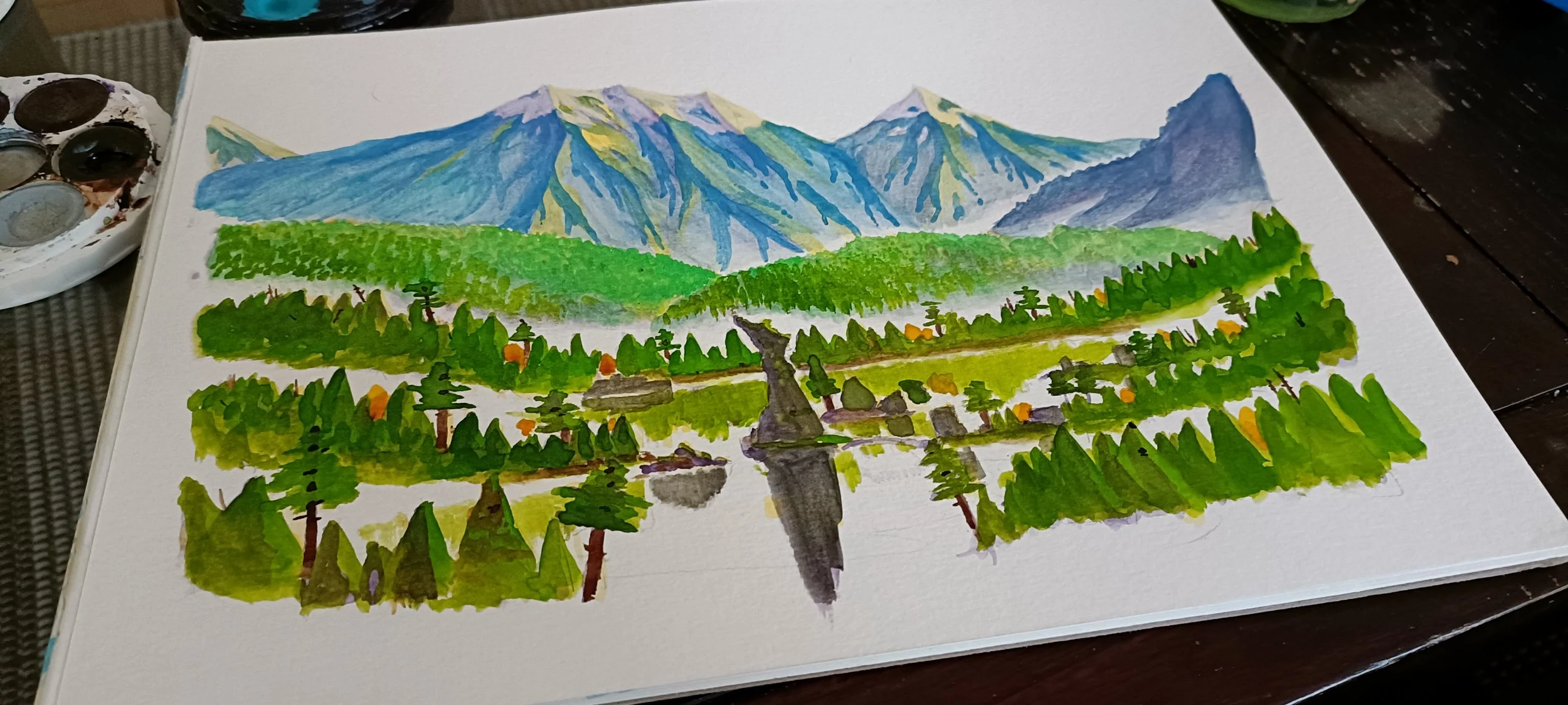
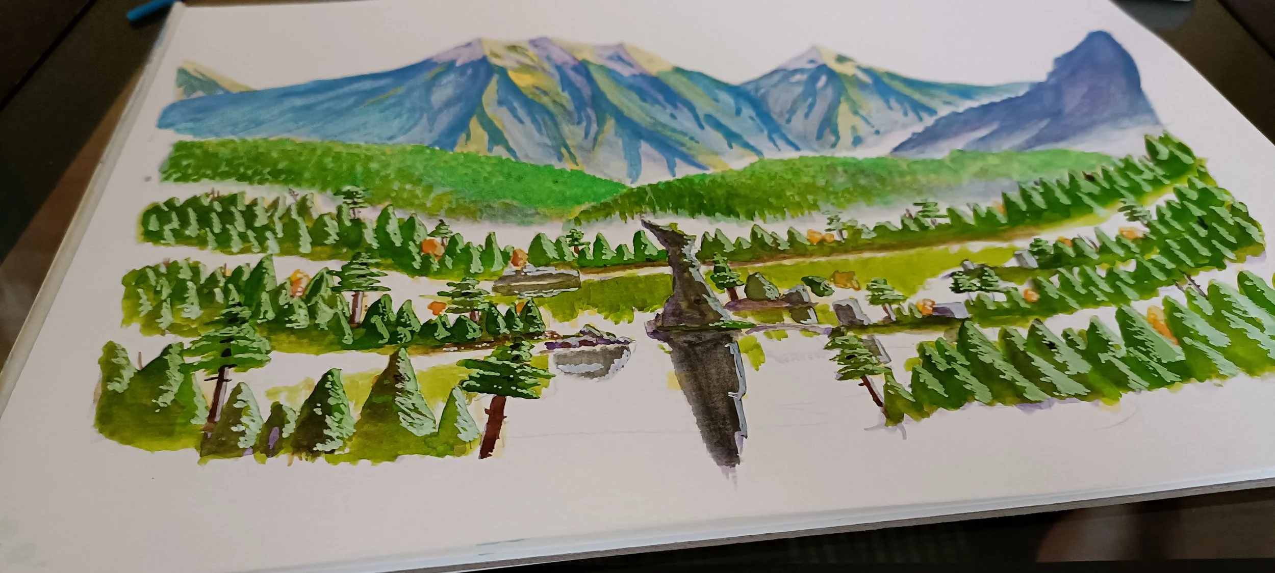
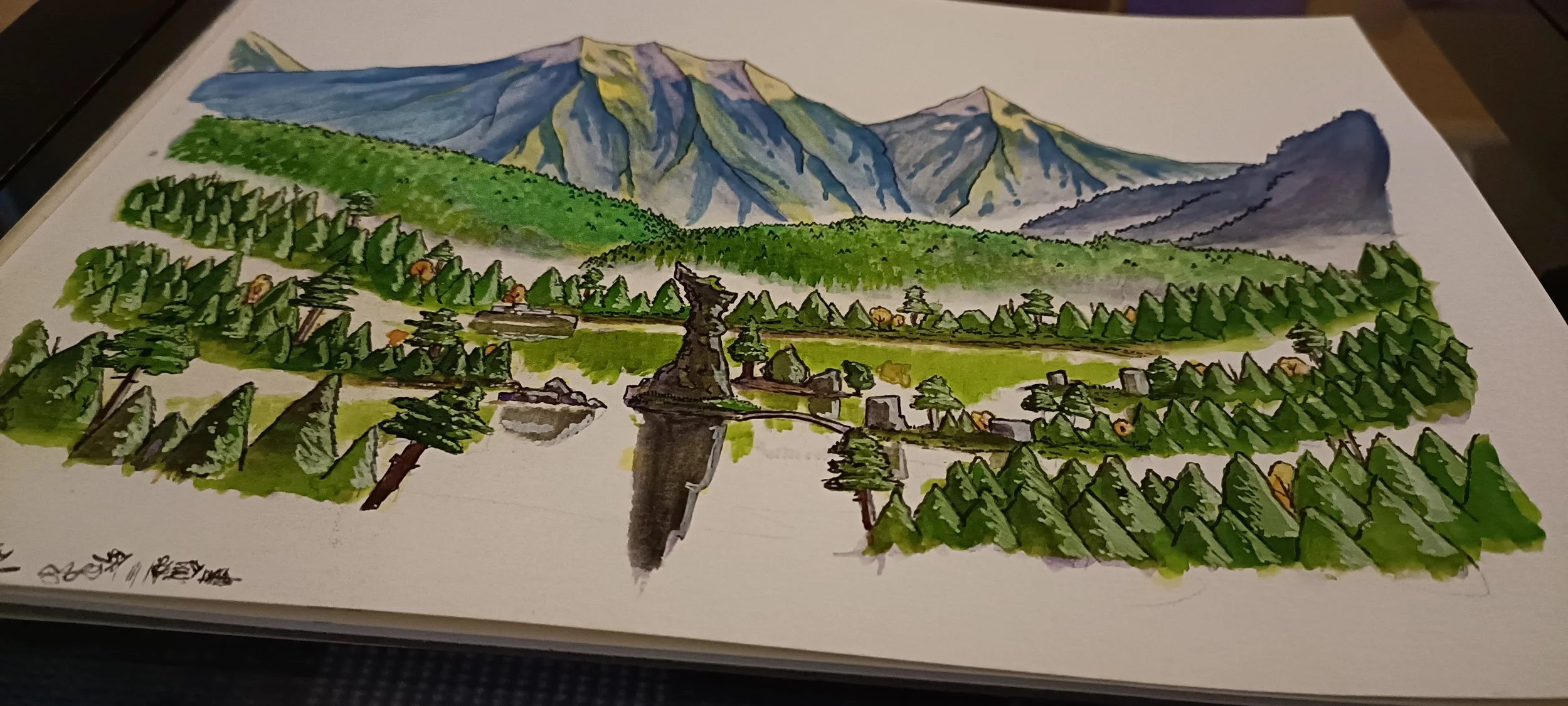
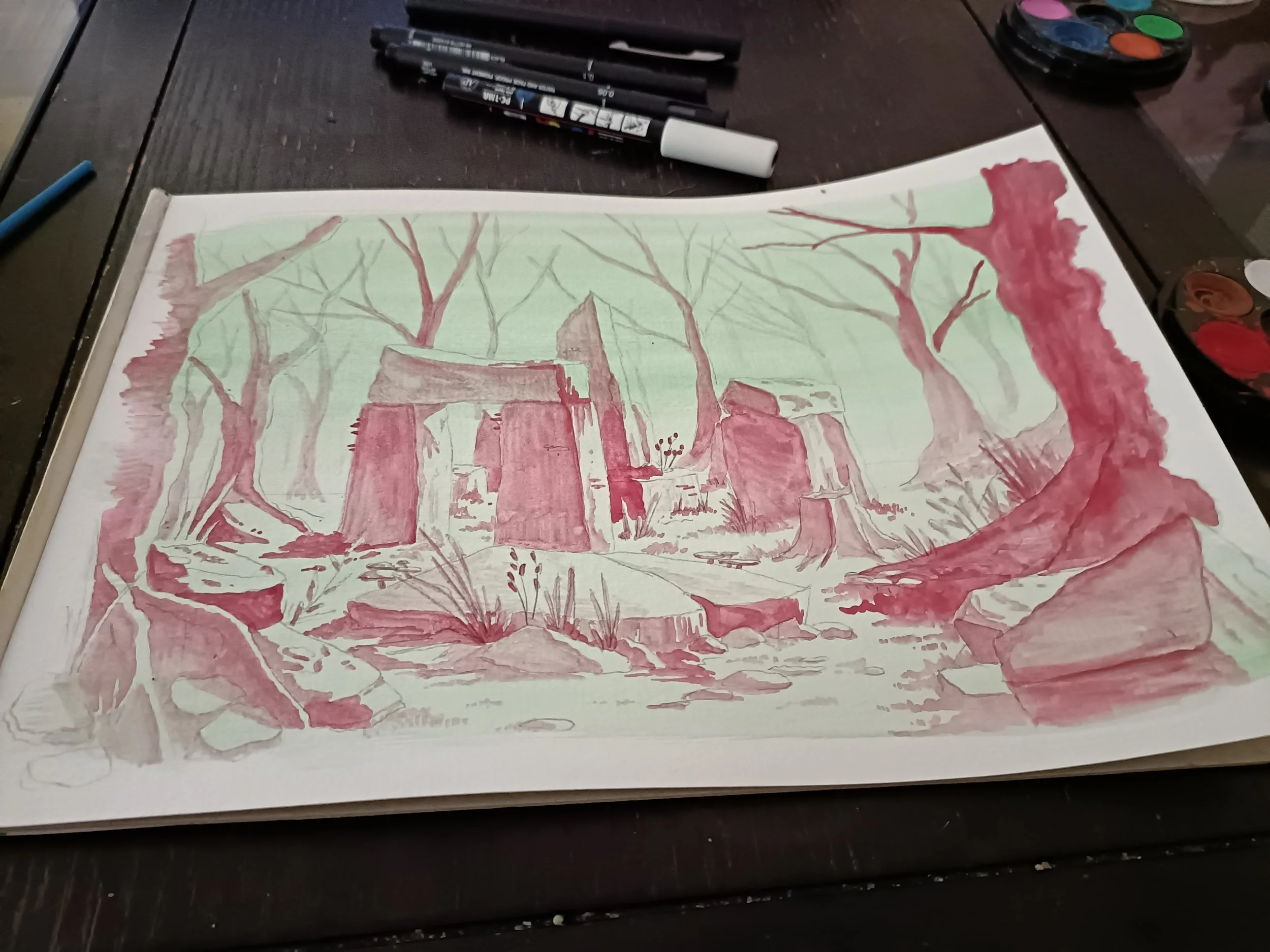
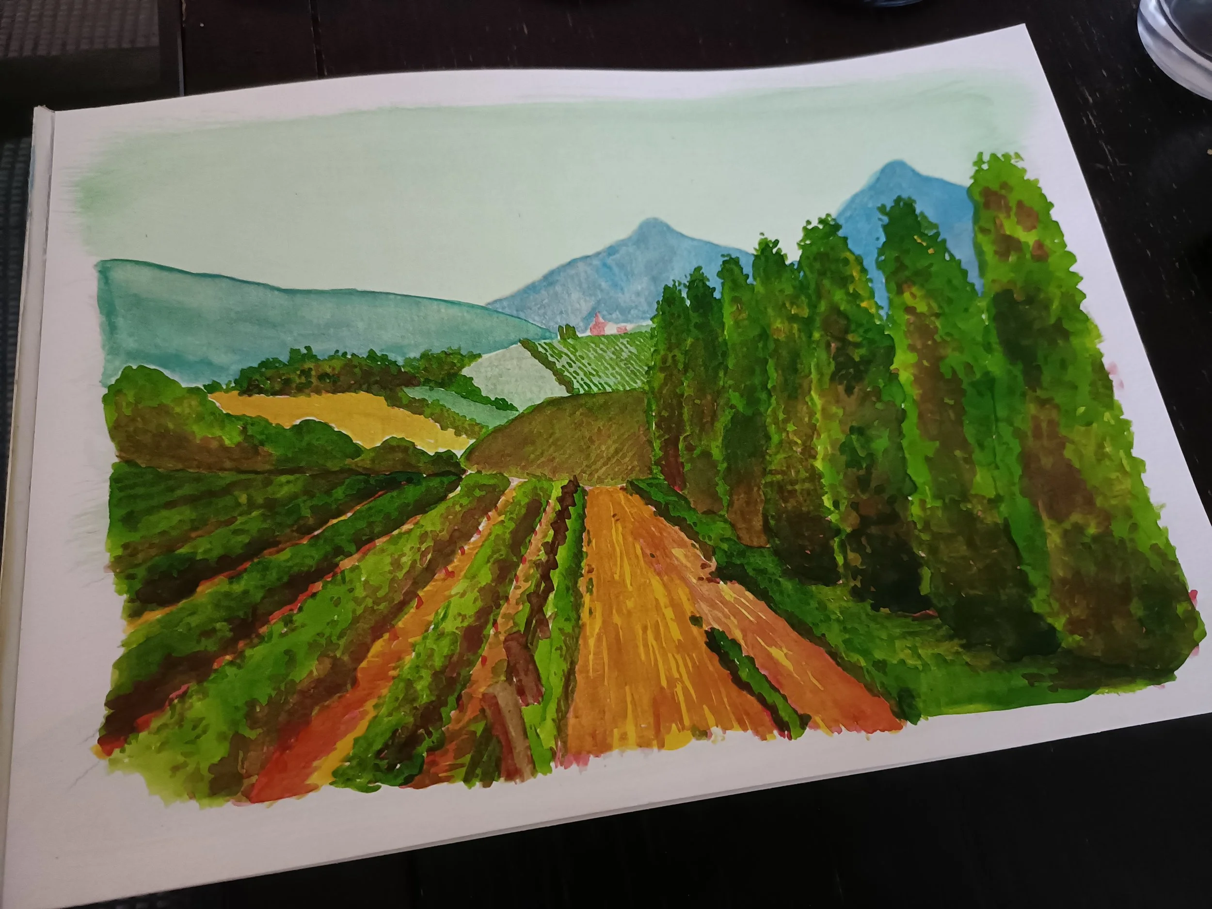
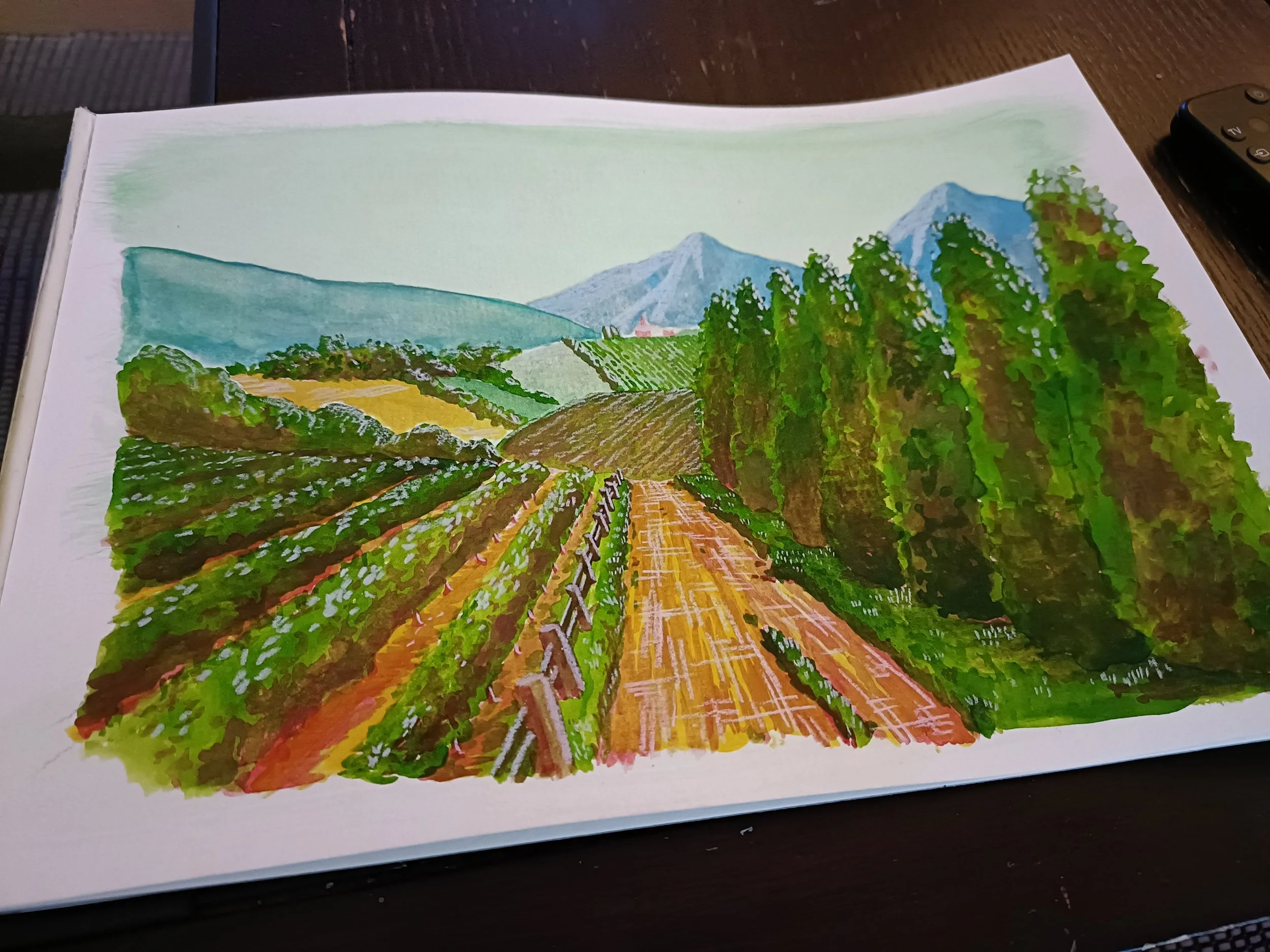
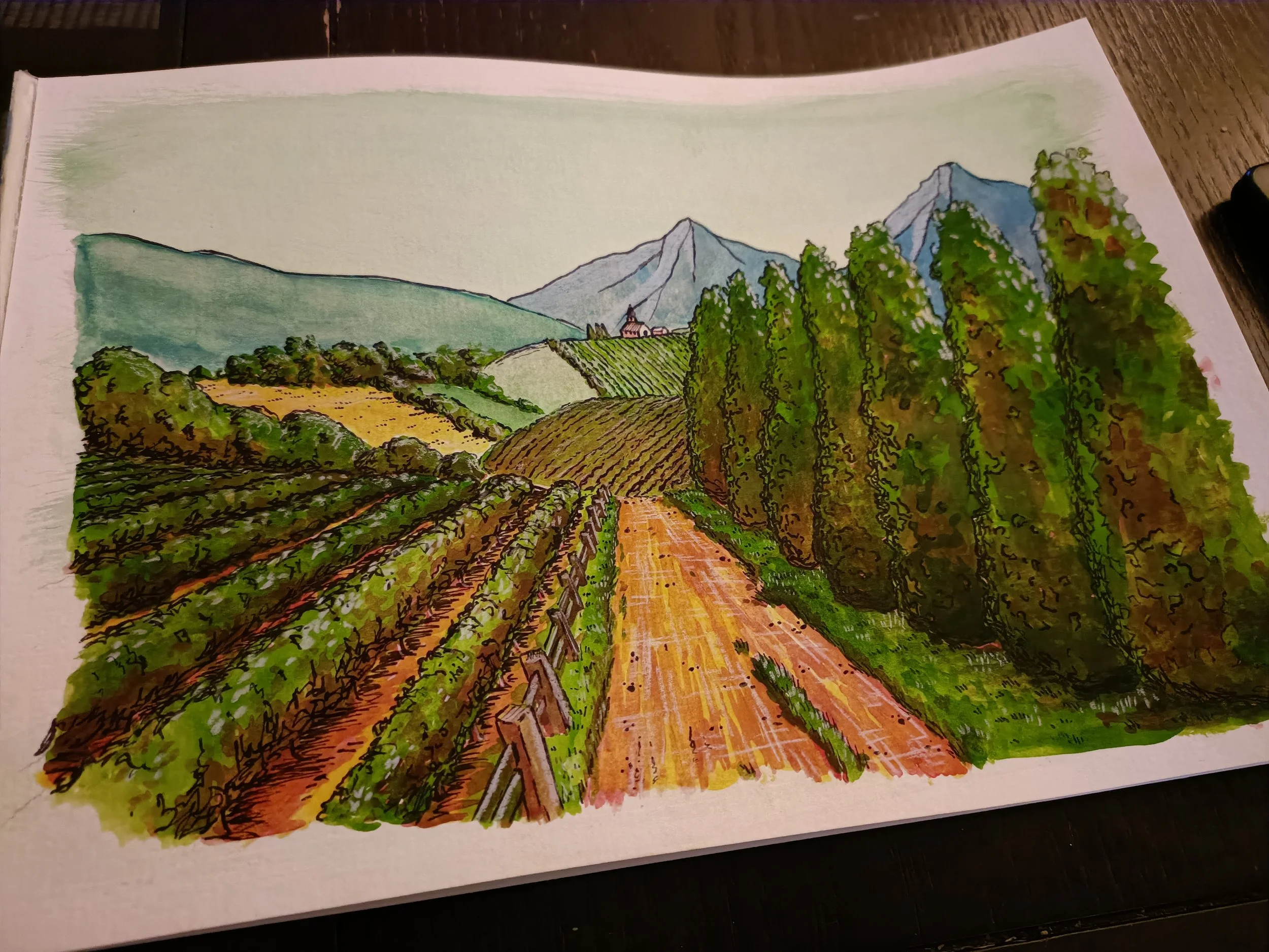
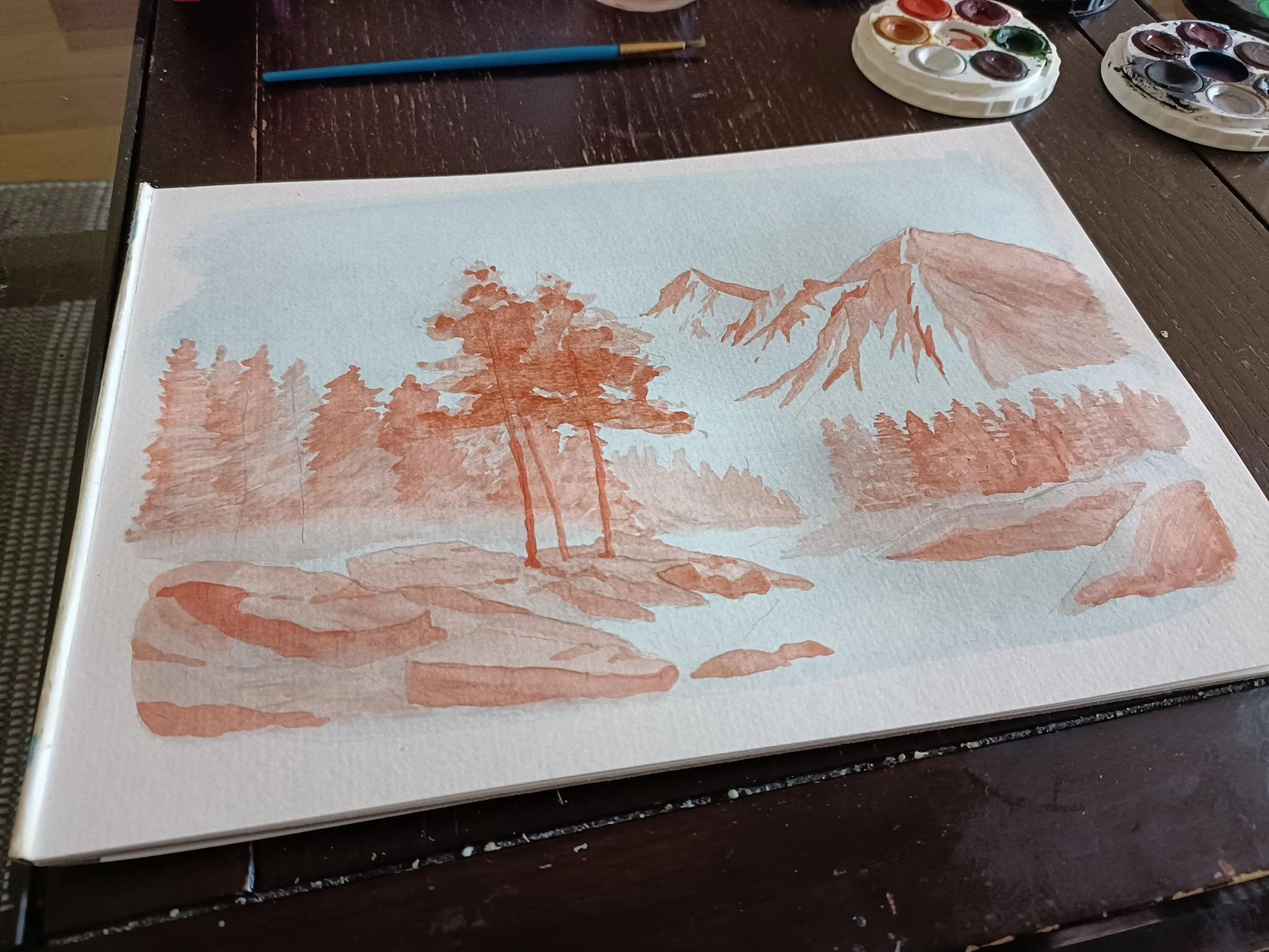
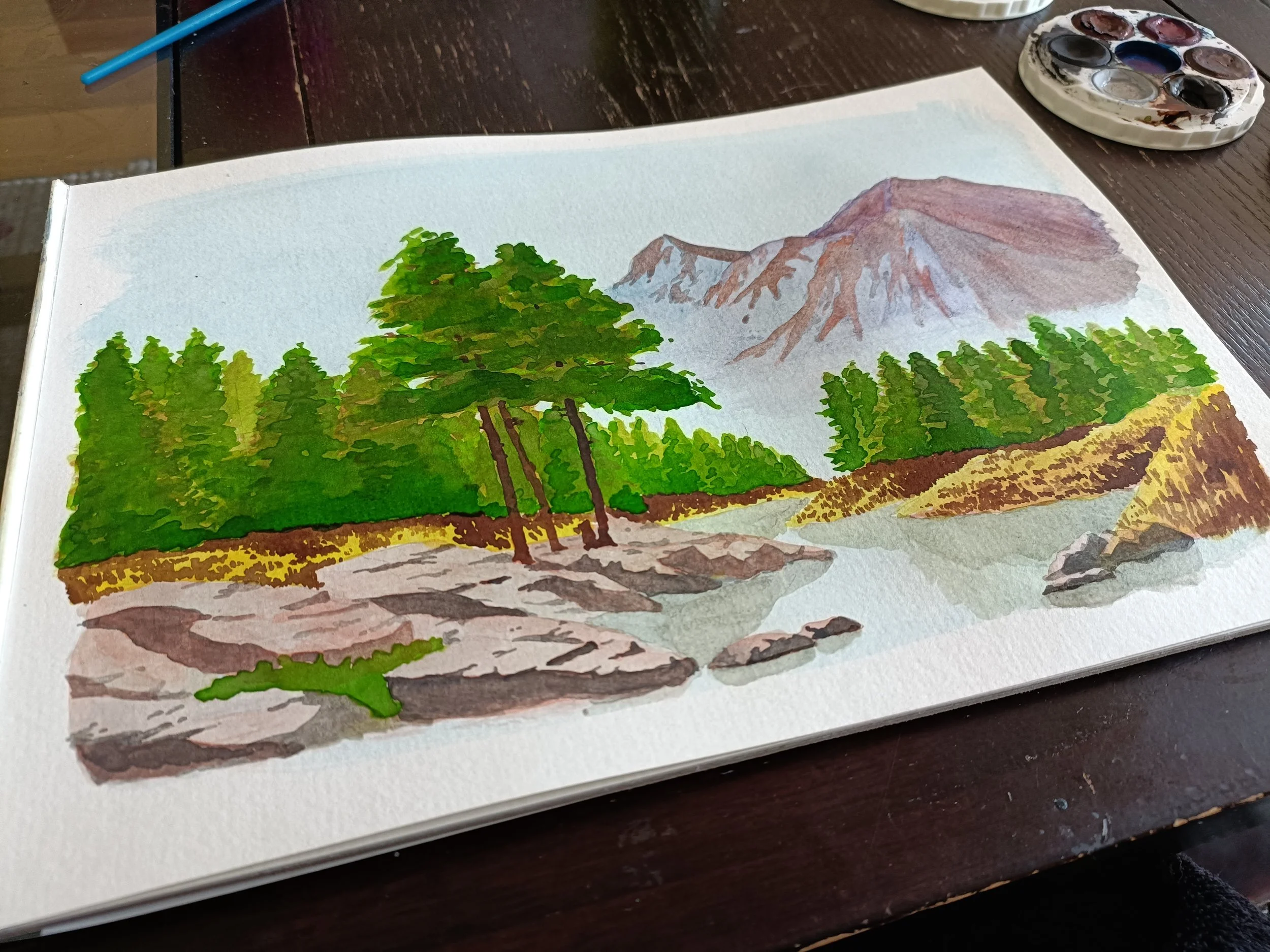
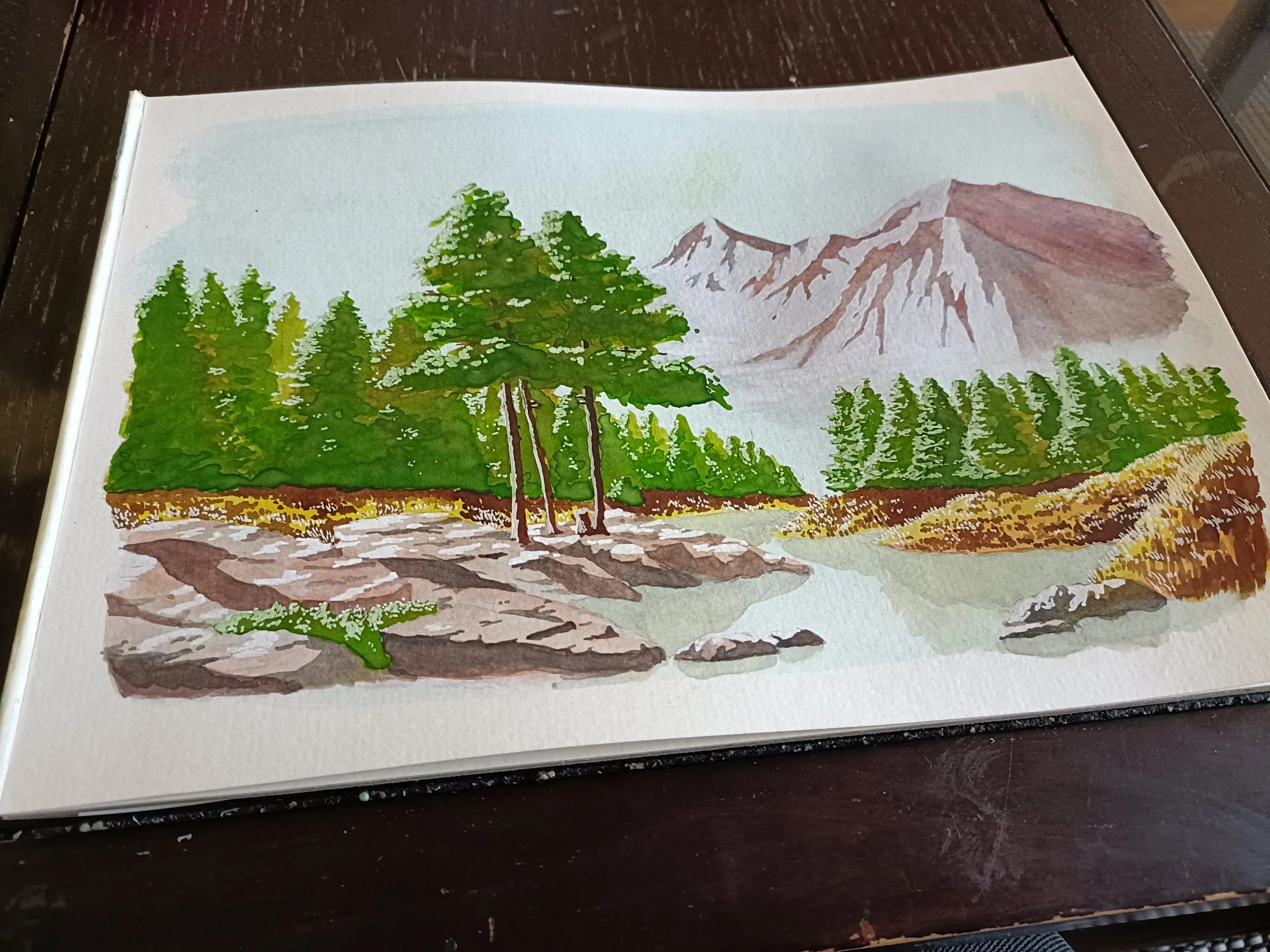
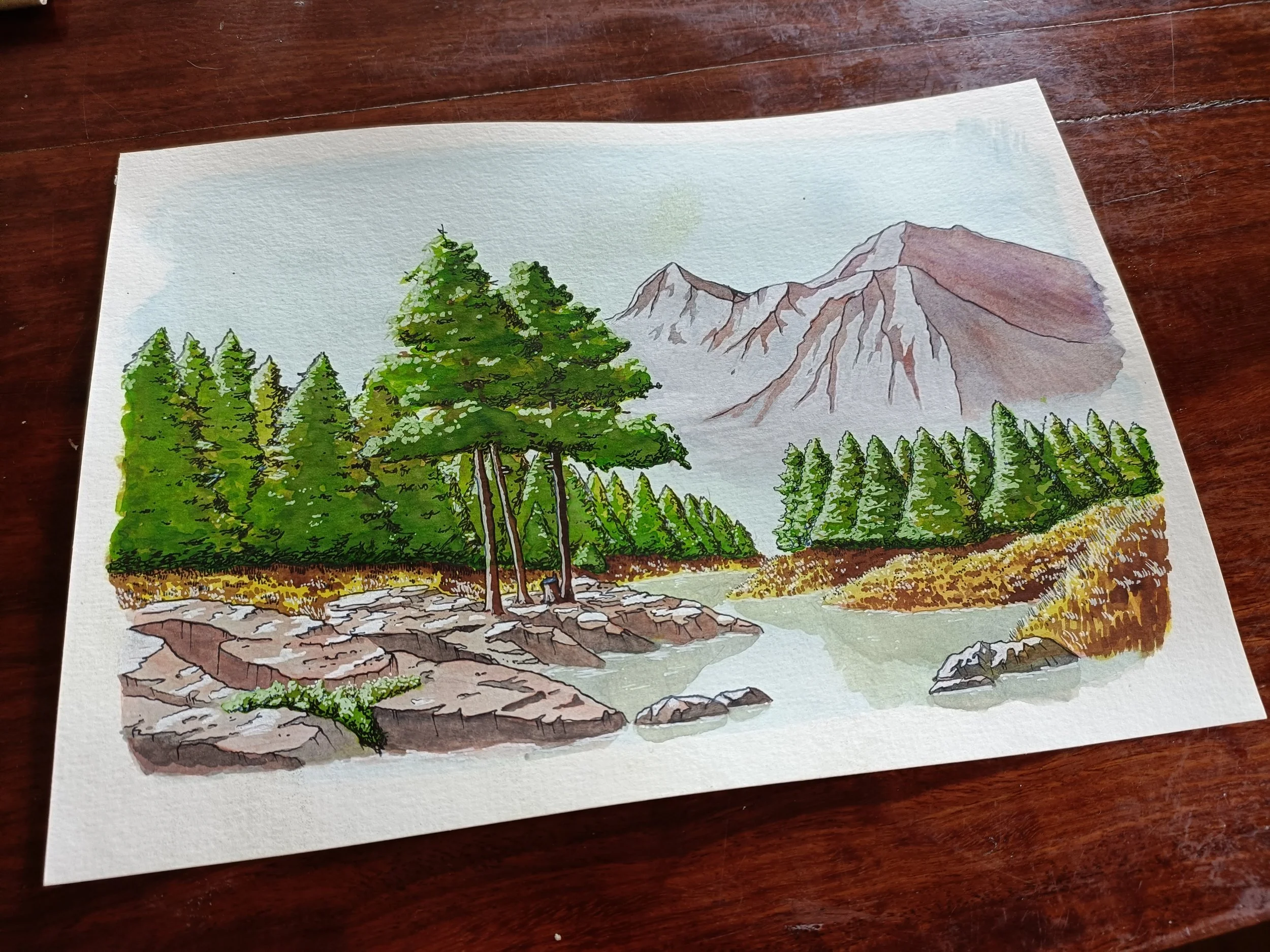
The selection beneath is the series of illustrations to pair with my own “The Atlas of Endon”: they are paintings of the places within the maps.
The Kingdom of Endon, nestled in the wide and fertile valley beneath the Iron Mountains, has been inhabited by one race or another for millennia. Legend has it that the first peoples here were the giants, but we know for certes that these rivers and valleys were also home to the goliaths, the yuan-ti, and other communities of dwarfs, kobolds, and orcs.
In fact, our race has been here for only a little over a millennia. We are strangers to this ancient and hallowed land, and though we can, arrogantly, claim the ownership of this place, we have built our peace and prosperity on the bones of those that came before us.
Our roads are yuan-ti, our holy places are goliath, and on clear days even from the capital one can look up and see, far off in the distance, the majesty of the Adgu-Skye. To claim that we and we alone are responsible for the beauty of the Kingdom of Endon would be folly indeed, and it is my duty, I feel, to remind you of that, reader.
The Ruins of Tol Fallent
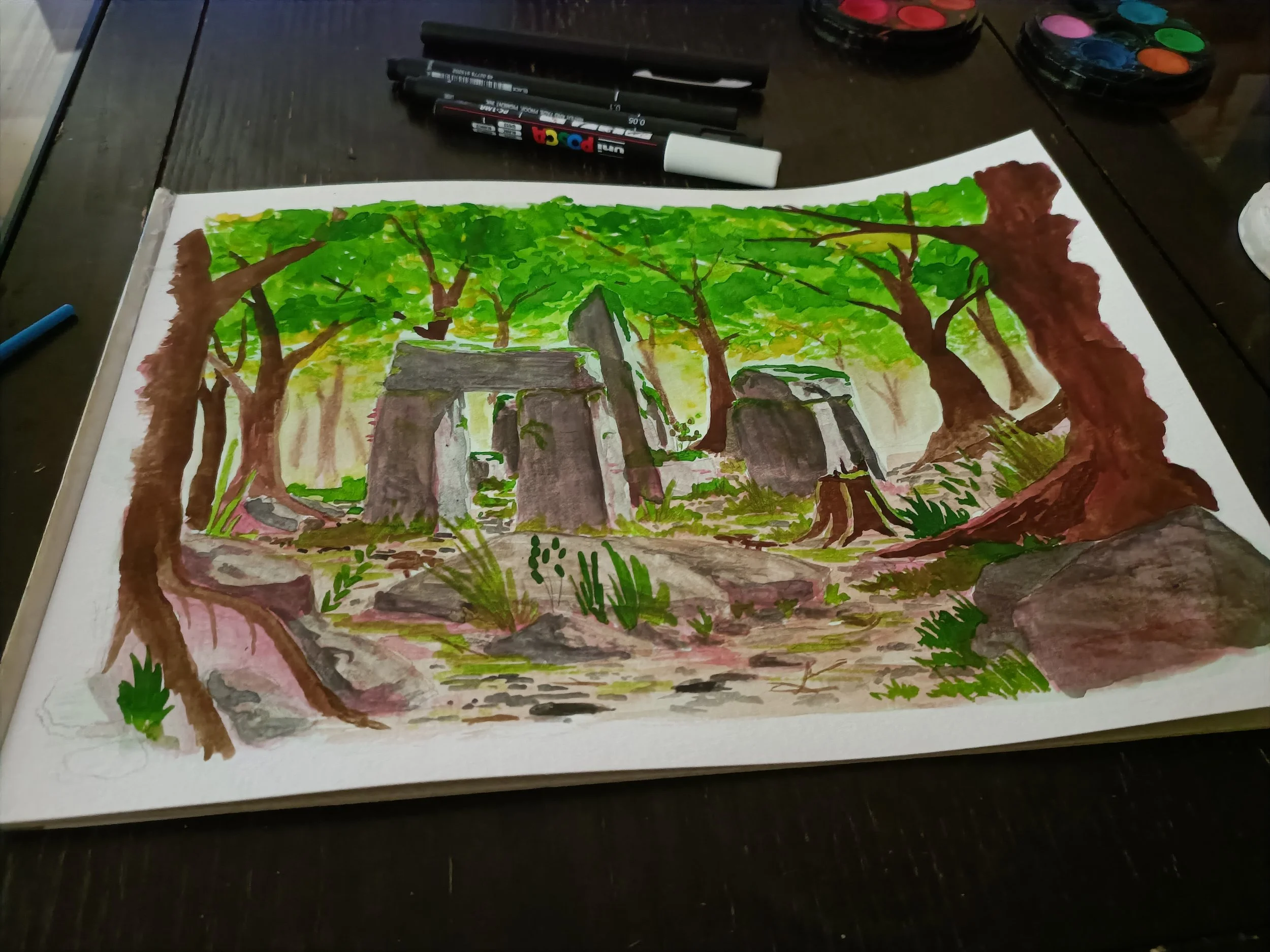
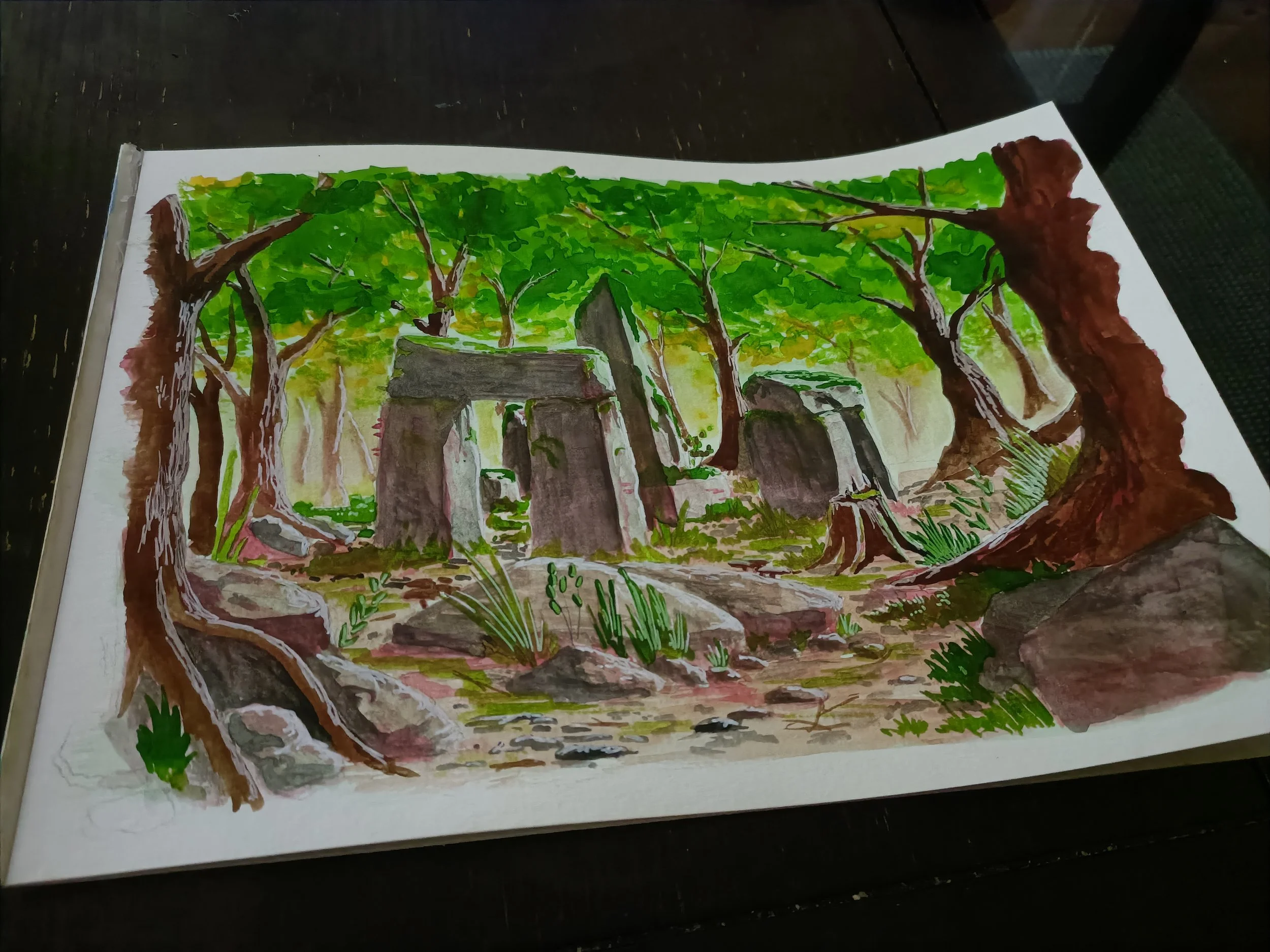
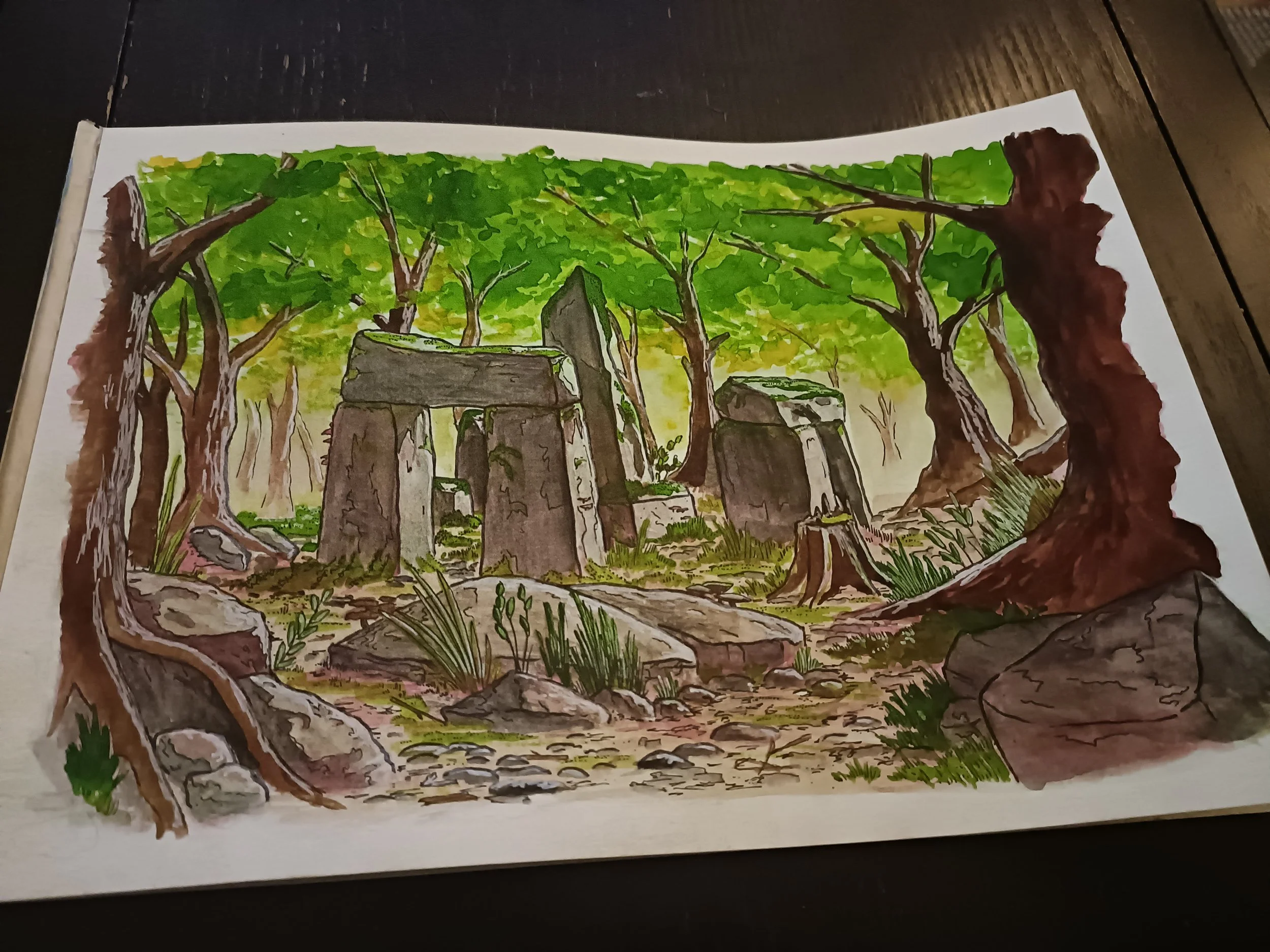
The Callidan Henge
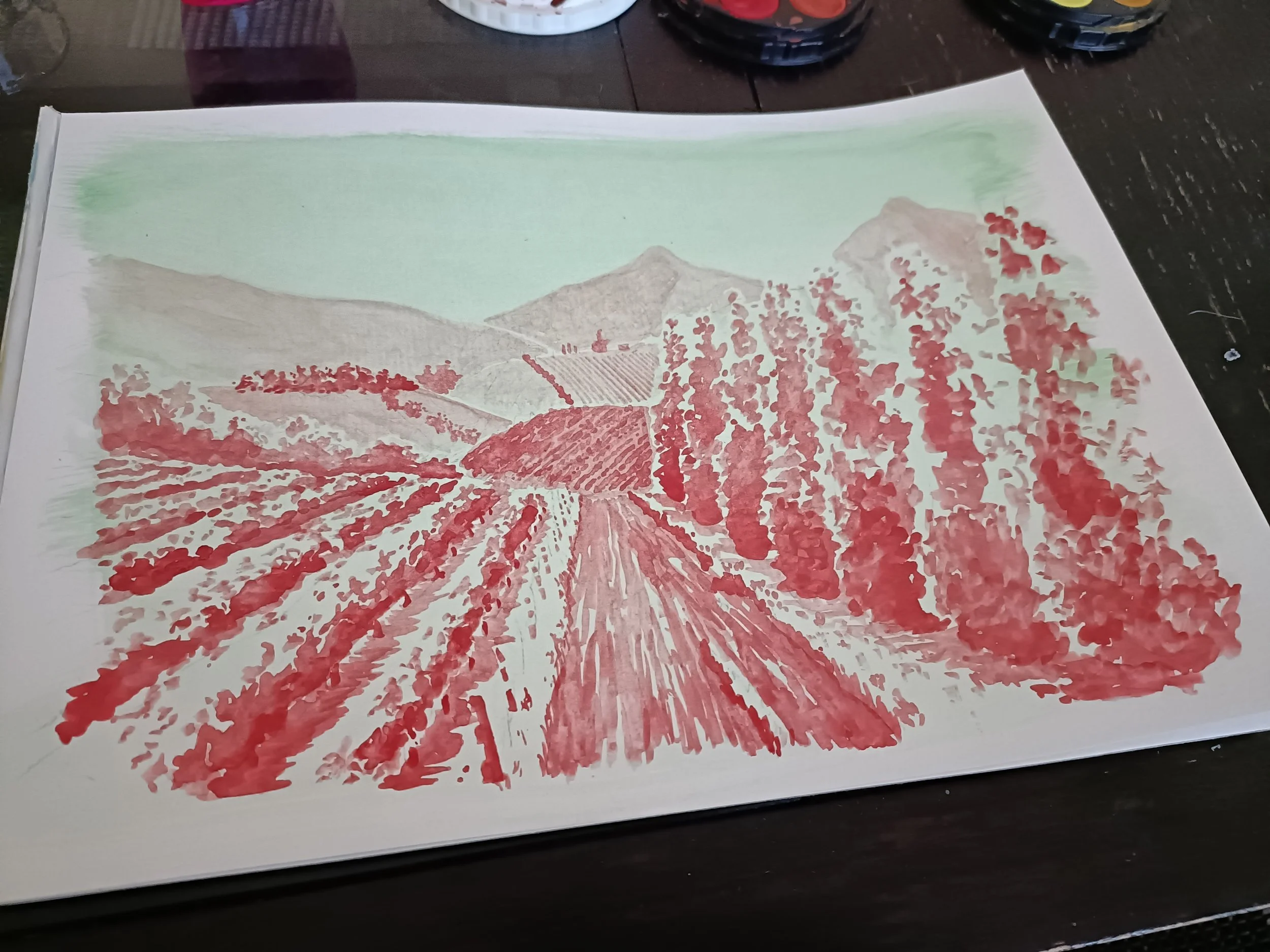
The Road to Riverbend
The Banks of the Withywindle
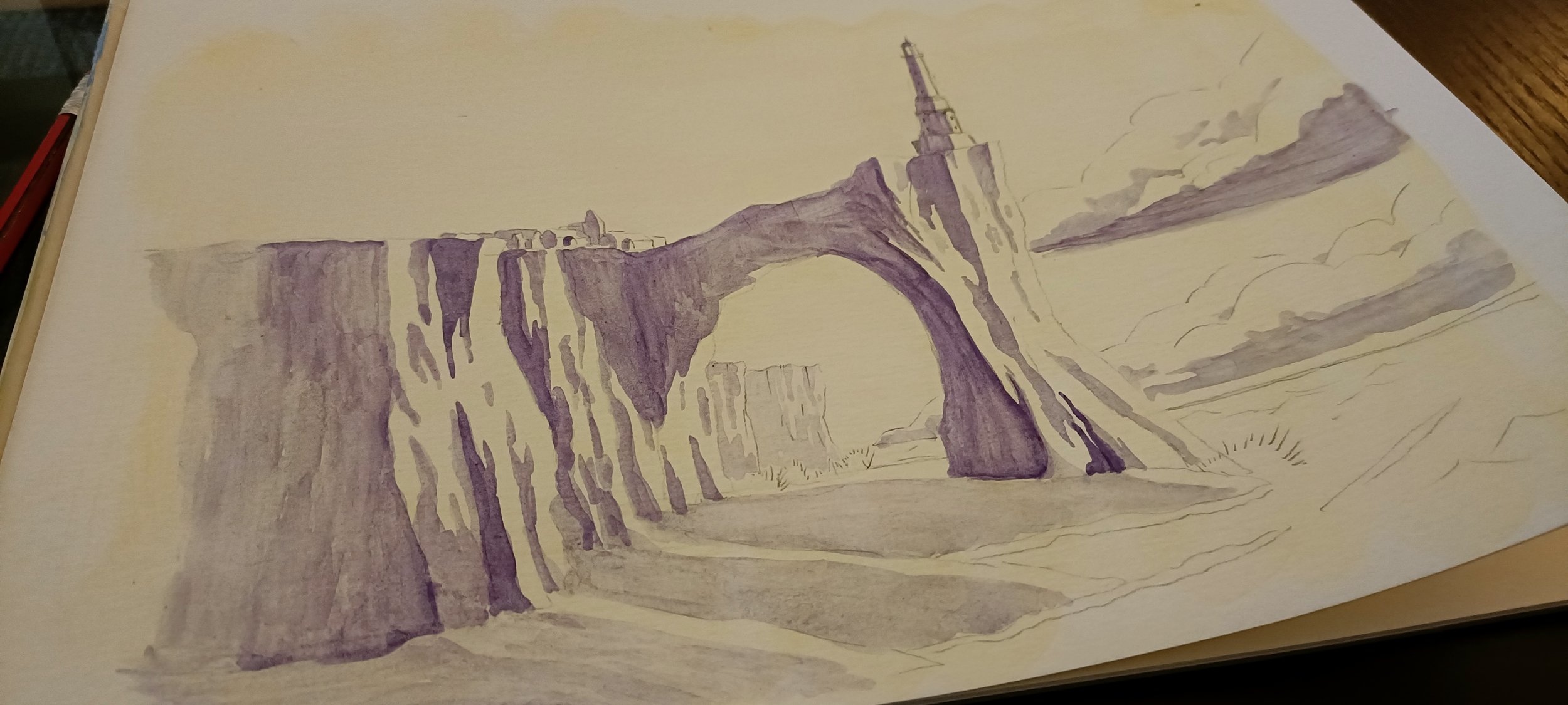
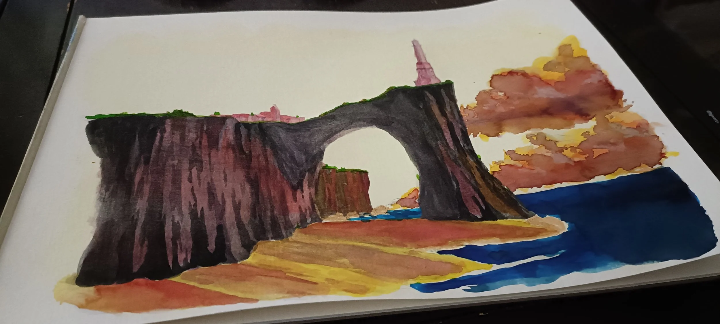
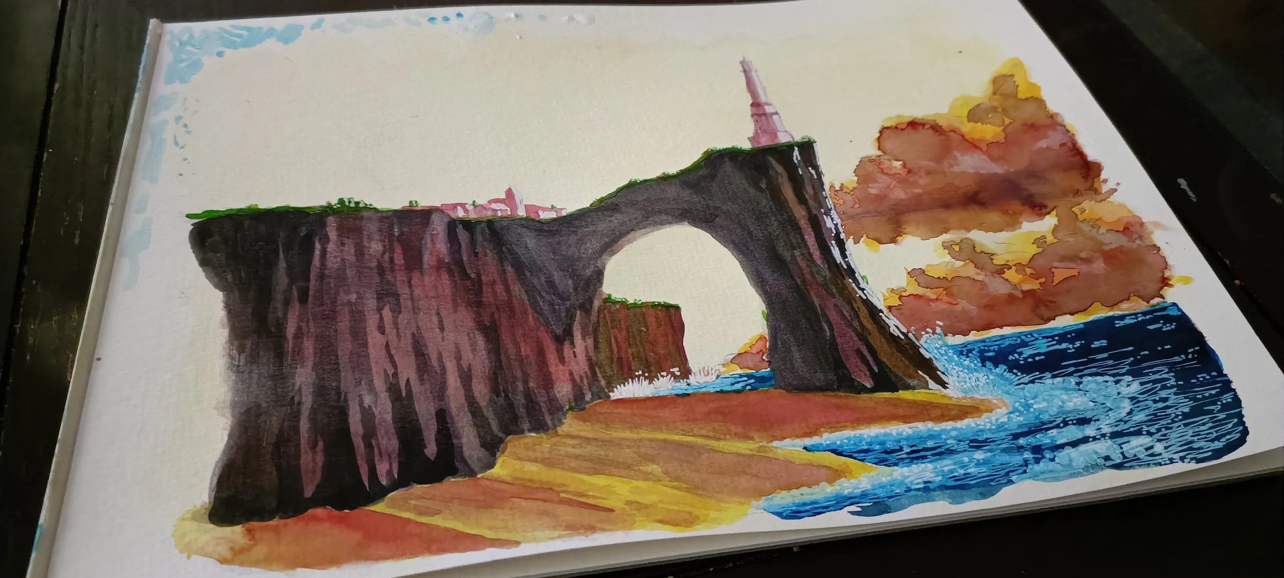
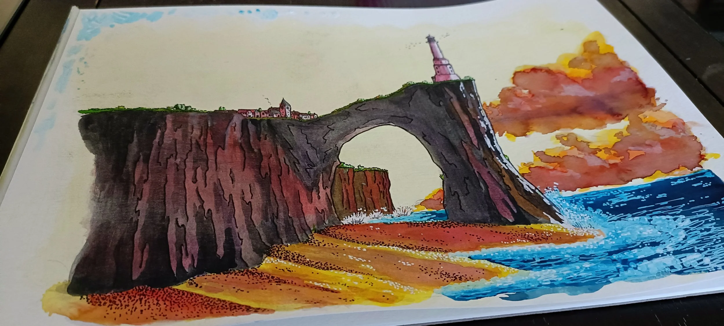
The Icetower Cliffs
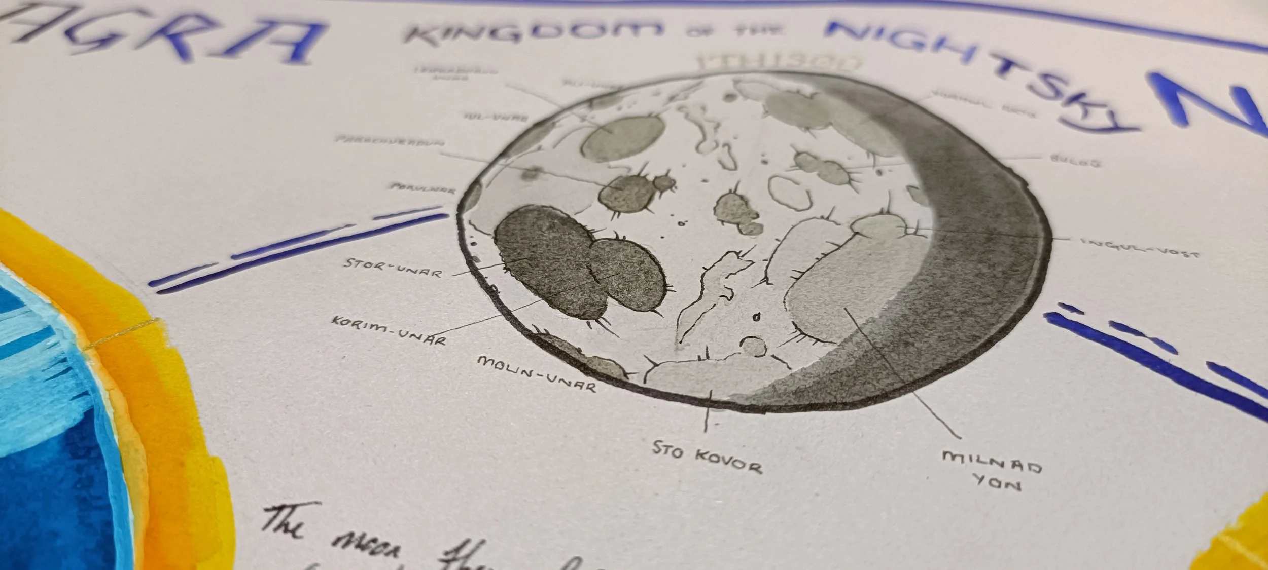
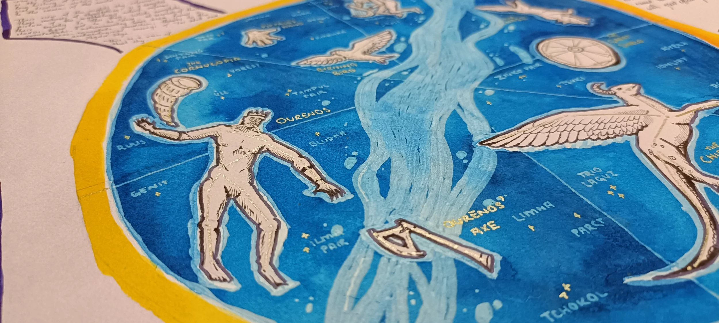
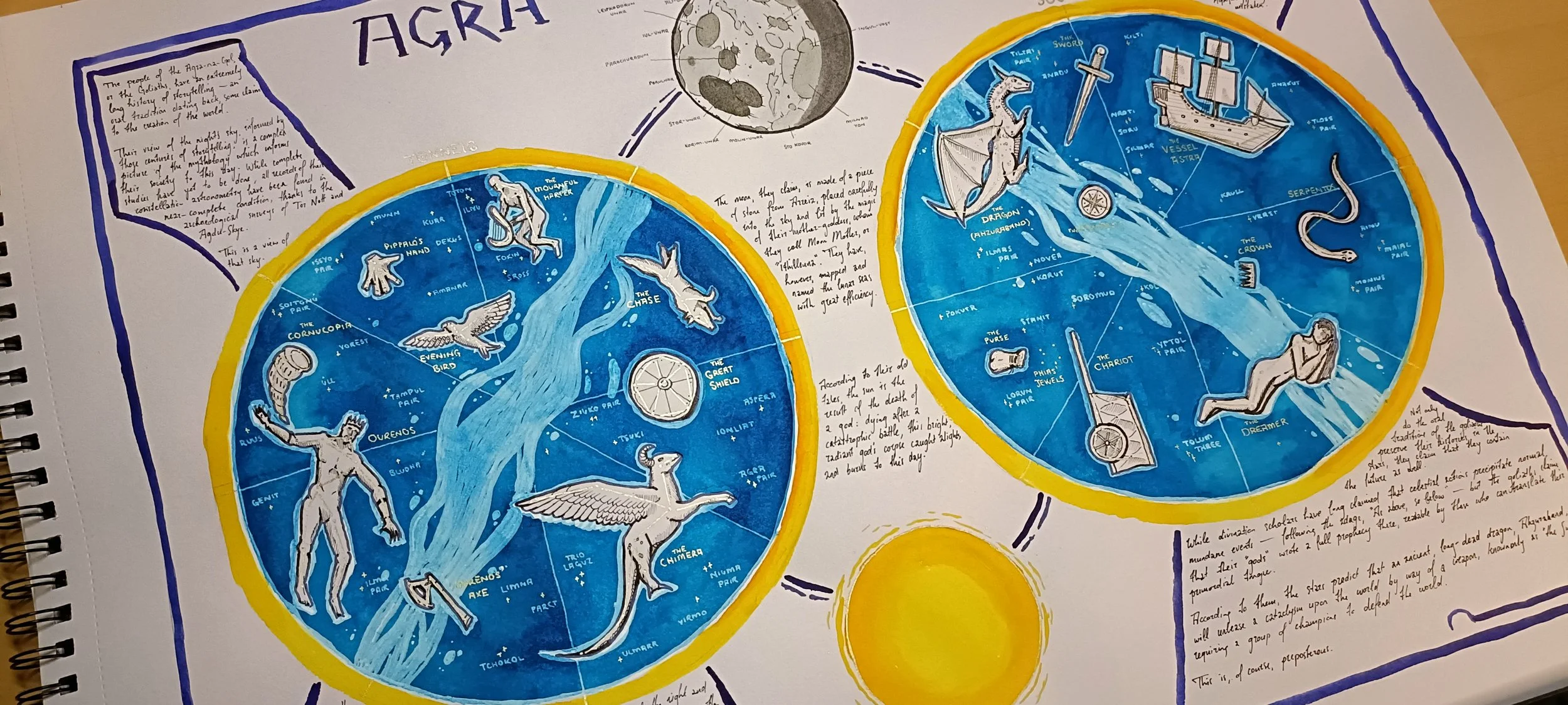
The Agra-Skye